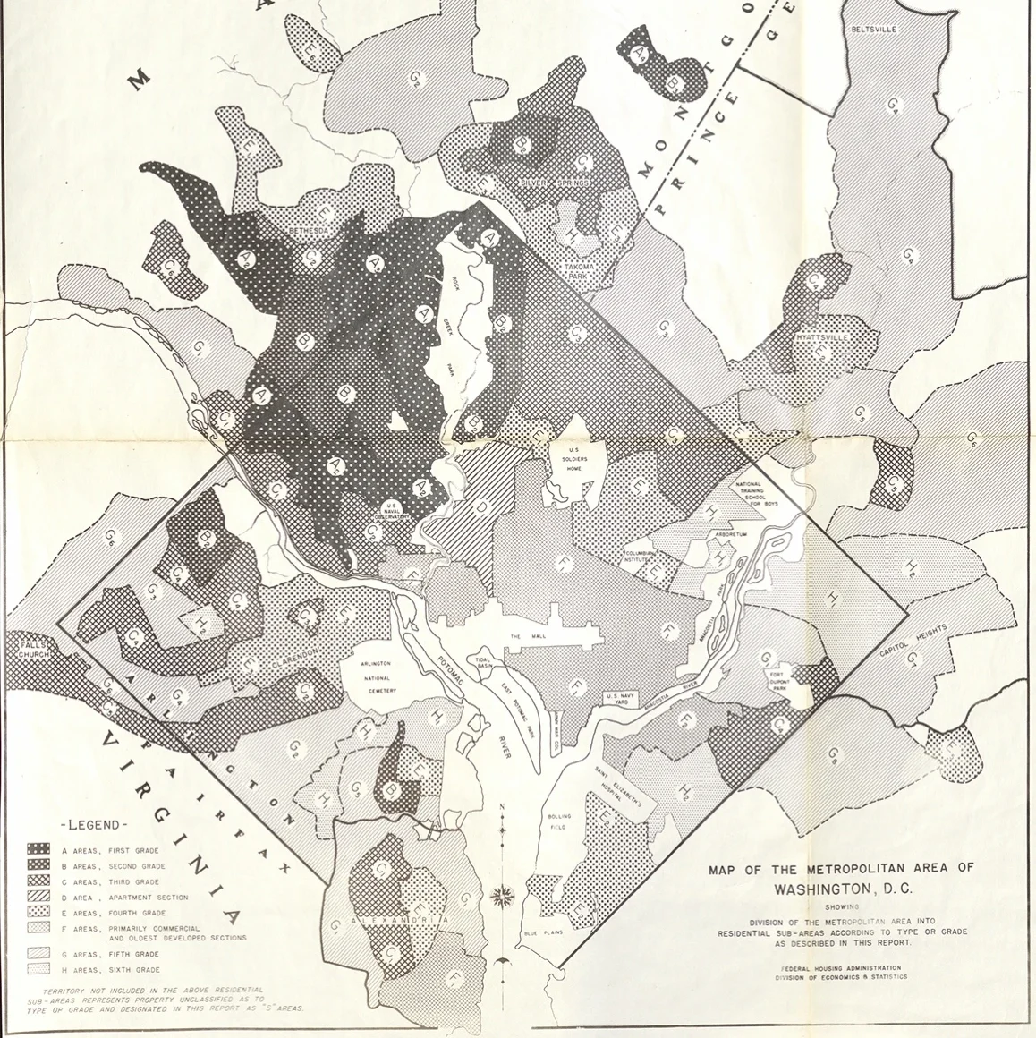
Mapping Segregation in Washington, DC is a public history project that documents the role of race in shaping the nation’s capital during the first half of the 20th century.Through interactive maps and archival research, the project reveals how racially restrictive covenants, federal policies, and local zoning codes institutionalized segregation and displaced Black residents.By highlighting the enduring legacy of these practices, Mapping Segregation fosters understanding and dialogue about racial equity and urban development.